Beach Accesses

Saltair has six beach access points from the North end of Saltair to the South end:
Solmie Road Access: – 18 steps – steep gravel grade use caution – pebble beach.


Davis Lagoon Access: – access from Pull out at Lagoon Bridge, mix of pebble and sandy tidal flats at low tide.

Known as Davis Lagoon, or just “the Lagoon” by locals, this is a special place where Stocking Creek meets the ocean and the tide fills it up and empties twice each day. The EJ Hughes painting shows the view from the Lagoon Bridge to the beach and dock as it looked in the 1960s and 70’s .
This area is a popular location for kayakers and locals to observe the weekly log barge in action.
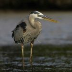
Sandy tidal zone at this ocean lagoon teems with an abundance of wildlife.


Click here for a map of Davis Lagoon
Bazan Road Access: – 58 steps – pebble beach


Skinner Road Access: – 26 steps – pebble beach
South Oyster School Road Access: – 63 steps – Boulder/Big Rock – pebble beach with a sandy beach at low tide

Cliffcoe Road Access: – 87 steps – pebble beach
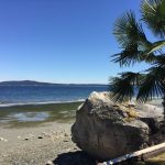
Low Tides allow for plenty of room to walk along the beach and admire the wonderful views of Stuart Channel with the north shore mountains towering in the distant back drop. Stop to explore the interesting shaped beach pebbles and weathered pieces of natural oyster shells, or unique bits of driftwood scattered along the shore.


You may even spot otters or seals frolicking about and other water fowl trolling the peaceful waters.


Boulder Point/Big Rock beach at the end of South Oyster Road offers a lovely sandy beach at low tide, suitable for swimming, snorkeling and beach picnics.


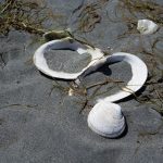
There is an abundance of sea creatures visible during low tide which leaves the sea life vulnerable to harm.


Please only take photos and do not remove live creatures from their habitat.
High Tides: ocean levels rise which can make the beach slowly disappear under water. You can still enjoy the soothing sound of rolling waves and take great photos of the scenery. It is always a good idea to check tide levels before your next walk on the beaches of Saltair.
Saltair beaches are not equipped with designated safe swimming areas. There are no lifeguards on duty. Swim at your own risk.
There are no facilities at the above noted beach accesses. Please take your trash with you. Pets must be on leash and don’t forget your sunscreen!


Plan your visit by looking up tide charts. Click this link for current tide schedule
Centennial Park
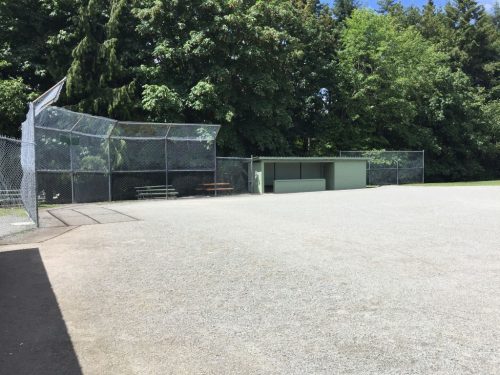
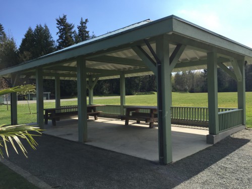
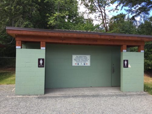
This large, multi-sport community park in Saltair offers two ballfields, picnic shelter, playground, basket ball/hockey courts, two tennis courts, two pickle ball courts, and washroom facilities. All pets must be on leash.
Multi-Sport Use


South end – Frost Field Diamond
How to get there:
At the south end of Ladysmith, turn east off the Trans-Canada Highway onto Chemainus Road. Follow the road across Davis Lagoon into Saltair then take a left onto South Oyster School Road. The driveway to the park is on the right next to the Saltair Community Centre.
Saltair Parks & Trails
Area G – Saltair Parks

Stocking Creek Park
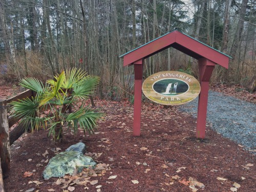
Saltair’s Hidden Jewel – Stocking Creek Park
In 1988 the BC Provincial Government approved a grant of the 5.14 hectare property for park use by the CVRD, initiating the beautiful community park and protecting a corridor along Stocking Creek to Davis Lagoon. Len Platt, who was the CVRD Director of Area G when this first parcel of land was acquired, realized the special natural qualities of this area and pursued further land acquisitions to expand the park. Len was the leader behind the community vision for a park corridor along the creek to the ocean. With nine further acquisitions of land the park has expanded from the original 5.1 hectare to 15.6 hectares. There still remains a few more pieces of the puzzle needed to complete the corridor to Davis Lagoon and protect the creek as parkland, the vision and efforts of the Area G Parks Commission and current Area Director continue to uphold this endeavor.
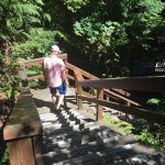
- Features: beautiful trails and a picnic area make Stocking Creek Park the perfect place for a nature walk. There are many km of trails meandering through the rainforest that lead to the creek and to the falls.
-

Trail to Stocking Creek Falls and viewing platform 
Stocking Creek Falls in Summer -

Bridge over Stocking Creek - Park size: 14.87 ha
- Amenities: Picnic area, Trails, and Parking on Finch Place and Thicke Road.
- How to get there: East off the Trans-Canada Highway onto Chemainus Road. There are two entrances to the park. One is off Thicke Road and one is west off Gait Road then right on to Finch Place. Parking at the end of Finch on the road.
- All Pets must be on leash and pick up waste.
- Walking on designated trails helps minimize damage to fragile plants and disturbance to the smaller animals that live in our parks. Use extreme caution during fire bans to prevent forest fires. Open fires and smoking are not permitted in CVRD parks.
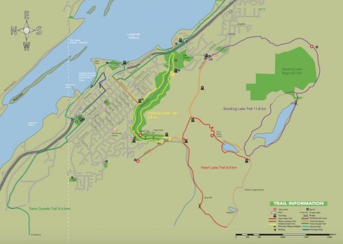
Click here for a View a map of Stocking Creek Park
Diana, Princess of Wales Wilderness Park
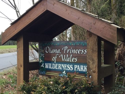
Diana, Princess of Wales Wilderness Park was created through the gracious donation of 23.3 acres to the Cowichan Valley Regional District (CVRD) in 2001.
The land was donated by the sisters Patricia Doornbosch and Diana Waddell (Hall) who felt the land, though suitable for development, was much more valuable to the community as a park. The sisters loved the native plants and wildlife found on the property and insisted “that it be a wilderness park that preserves the area’s natural forest”.


The sisters also desired the park be named after Diana, Princess of Wales to commemorate her recent passing and to honor the sister’s connection to the United Kingdom. Through communication with the Royal Family, Patricia Doornbosch achieved official approval to apply Diana, Princess of Wales Wilderness Park title to this new CVRD park.
Diana, Princess of Wales Wilderness park officially opened May 6, 2001. The park has since been expanded by a further donation from Patricia Doornbosch and by park land acquisition through subdivision. In total, Diana, Princess of Wales Park is just over 32 acres of beautiful coastal Douglas fir habitat. The Coastal Douglas Fir (CDF) bio-geoclimatic zone is limited to a very small portion of the south coast of mainland BC, and southeast portion of Vancouver Island and Gulf Islands.
- Features: Diana Princess of Wales Park, located in sunny Saltair (Electoral Area G), has an easy walking trail that leads you through beautiful natural landscapes from Olsen Road to Rocky Beach Drive.
- Park size: 12.12 ha
- Amenities: Trail
- All Pets must be on leash and pick up pet waste
- How to get there: East off Trans-Canada Highway onto Chemainus Rd. Left onto Olsen Rd. Note: On right hand side.
- Click here for a map of Diana, Princess of Wales Park
- Walking on designated trails helps minimize damage to fragile plants and disturbance to the smaller animals that live in our parks. Use extreme caution during fire bans to prevent forest fires. Open fires and smoking are not permitted in CVRD parks.
COWICHAN VALLEY TRAIL:

The Cowichan Valley Trail runs parallel with Stocking Creek Park . CVT Trail can be accessed at: Old Victoria Rd, Southin Rd, Saltair Rd, Thicke Rd, Finch Place, or North Watts Rd.
Heart Lake & Stocking Lake Regional Park